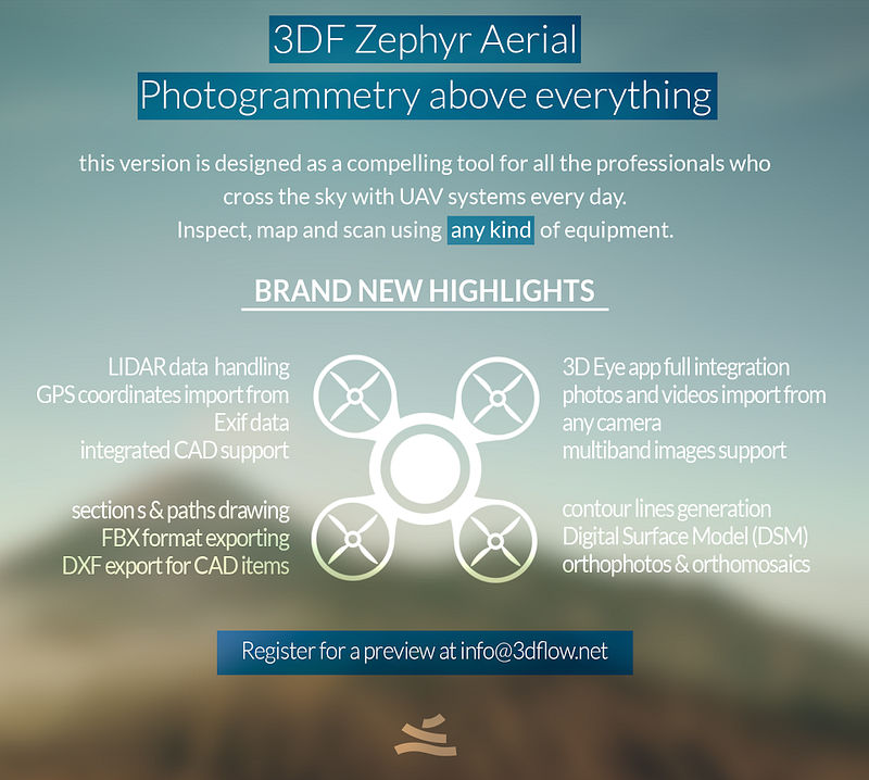
3Dflow have released Zephyr Aerial, their new image-based modeling software designed for surveying professionals that provides a set of tools for day-to-day geographic surveys and analysis, aerial/UAVs mapping, architecture and more. Zephyr Aerial offers contour lines generation with DXF export, GPS/exif and projected coordinate systems support, sections, etc.
Also of note, 3DF Zephyr Lite and 3DF Zephyr Pro have been updated to v2.1, adding the following features:
3DF Zephyr (all versions)
- Improved .zep file loading speed (you must save again your previously saved .zep files when asked to do so)
- Minor improvements in SfM and MvS phases
3DF Zephyr Pro only
- Shape from Silhouette – it’s now possible to create a dense point cloud from the sparse point cloud using masks rather than the classic MvS algorithm. This new approach is much faster (albeit much less detailed) and can be used to create quick dense point cloud previews (or to initialize the MvS phase) and to create rough shapes even of transparent subjects.
Those who purchased a Zephyr Pro license prior to October 8, can ask for a free license switch to Aerial if they wish to do so. A feature comparison list between the various 3DF Zephyr versions is available. More on 3Dflow’s website.


