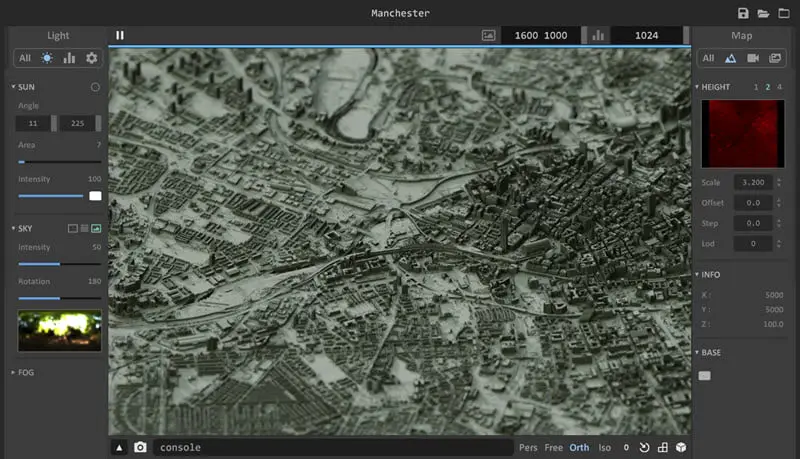
Ephtracy has released a free tool for visualising heightmaps. Aerialod is an interactive path tracer that allows you to import and render heightmaps. Find out more and download from the product’s website.


CGPress is an independent news website built by and for CG artists. With more than 15 years in the business, we are one of the longest-running CG news organizations in the world. Our news reporting has gathered a reputation for credibility, independent coverage and focus on quality journalism. Our feature articles are known for their in-depth analyses and impact on the CG scene. “5 out of 5 artists recommend it.”