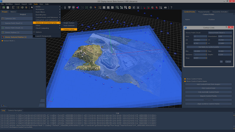
3Dflow, developers of the image-based modeling software Zephyr, have announced the upcoming release of Zephyr Aerial, a new software designed for surveying professionals that provides a set of tools specifically conceived for day-to-day geographic surveys and analysis, aerial/UAVs mapping, architecture and more. Zephyr Aerial will include tools for contour lines generation (both manual and automatic generation), single sections and track sections. Other features include a better georeferencing system (supporting Projected Coordinate Systems) and Exif/GPS data integration.
The new version will be available for purchase from Tuesday, October 13th, with the scheduled Zephyr 2.1 update. More information on 3Dflow’s website.


